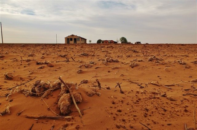
Migration is a natural human phenomenon. There are more than 175 million migrants in the world today. People leave their countries for many reasons, including war and civil conflict, the desire for economic improvement, family reunification and environmental degradation.
Migration adds a definitive layer to the city. City planners can anticipate the radical societal change generated by migration, in order to help cities, their populations, and industries to prepare.
The City is not built in a day. Each layer is created by people, by time, by movements, by politics. It develops, matures, ages sometimes becomes derelict and often reborn like Delhi. It is like a living organism.
Migration is increasing
One out of every seven people in the world is a migrant. Understandably cities have always been priority destinations for migrants, offering opportunity and the chance for a new start. Emerging factors like the global loss of habitat caused by climate change are also spurring ever greater migration around the world, increasing the need for provisional accommodation.
In 2015, over a million people applied for asylum in the EU, being displaced persons, escaping from conflicts in their countries or just looking for better living conditions. The arrival of a large number of refugees has created significant challenges to urban governance, planning and urban design in many European cities as a result. Questions for cities have arisen, such as how to assist, house, train and integrate individuals from different cultures.
Migration also brings Social Change especially in the case of rural-urban migration. Rural-urban interaction is an important aspect of urbanisation. It is very probable that urbanisation and urban growth would have their impact on rural areas and activities in rural areas would have their effect on the nearby towns and cities.
Urbanisation has impact on the economy and society of the surrounding villages. There is increase in farm productivity (due to the availability of fertilizers, better seeds, tractors, etc., in nearby cities), increase in commercialization of crops and decline in the density of farm population.Villagers imbibe several urban characteristics in day to day life . Rural society also undergoes a certain change.
City migration solutions
Since the ‘refugee crisis’ started in Europe, many cities have shown exemplary abilities to find local solutions and an ability to adapt to the needs of a changing population. As Mayor Ada Colau stated in 2015 while launching the Barcelona, Refuge City action plan, ‘it may be that states grant asylum, but it is cities that provide shelter’.
In Leipzig, Germany, groups are providing communal apartments for small numbers of people, and social workers are coordinating volunteers to support refugees’ integration. In Berlin, modular housing initiatives are being developed, creating container villages to house refugees.
The ‘Kinetic City’
As architect and professor Rahul Mehrotra advocates, humanity is already creating in many places of the world what he calls the Kinetic City or temporary informal settlements where ‘nothing is forever and nothing is sacred’. For example, every 12 years, around seven million pilgrims gather in Haridwar, India, to create a temporary settlement while taking part in the Kumbh Mela. As Mehrotra says, this reality shows the ‘changing roles for people and spaces in our urban society’, so our cities must be able to ‘expand and contract’ accordingly.
It’s vital that urban practitioners and professionals draw on existing best practice and discuss how to design and support cities as they face the challenges of a moving population – for instance understanding the needs of a temporary population, as suggested by the German Pavillon at the last Venice Biennale among others.
By working closely with public and private sectors, planners can understand migration, discuss possible frameworks of action, and commit to creating more sustainable, equitable and balanced cities.
Dissatisfaction with the models and theories developed by the positivists, using the statistical techniques which were based on the ‘economic rationality’ of man led to the development of the behavioural approach in geography. It goes out of the idea that people are the determining factor in the explanation of space. Behaviouralism tries to give an explanation of the spatiality of human activities. And thereby they use a complex universally applicable model.
It was increasingly realized by the geographers that the models propounded and tested with the help of quantitative techniques, provided poor descriptions of geographic reality and man and environment relationship. Consequently, progress towards the development of geographical theory was painfully slow and its predictive powers were weak.
Theories such as Central Place Theory, based on statistical and mathematical techniques, were found inadequate to explain the spatial organization of society. The economic rationality of decision-making was also criticized as it does not explain the behaviour of floodplain dweller, who does not leave his place despite the risk of flood.
It was a psychological turn in human geography which emphasized the role of cognitive (subjective) and decision-making variables as mediating the relationship between environment and spatial behaviour. The axiom of ‘economic person’ who always tries to maximize his profit was challenged by Wolpert. In an important paper, Wolpert (1964) showed that, for a sample of Swedish farmers, optimal farming practices were not attainable. He concluded that the farmers were not optimizers but, in Simon’s term, satisficers.
The objectives of behavioural approach were:
1. To develop models for humanity which were alternative to the spatial location theories developed through quantitative revolution;
2. To define the cognitive (subjective) environment this determines the decision-making process of man;
3. To unfold the spatial dimensions of psychological and social theories of human decision-making and behaviour;
4. To explain the spatial dimensions of psychological, social and other theories of human decision-making and behaviour;
5. To change in emphasis from aggregate populations to the disaggregate scale of individuals and small groups;
6. To search for methods other than the mathematical and statistical that could uncover the latent structure in data and decision-making;
7. To emphasize on procession rather than structural explanations of human activity and physical environment;
8. To generate primary data about human behaviour and not to rely heavily on the published data; and
9. To adopt an interdisciplinary approach for theory-building and problem-solving.
The fundamental arguments of the behavioural geography to achieve these objectives are that:
(i) People have environmental images;
(ii) Those images can be identified accurately by researchers; and
(iii) There is a strong relationship between environmental image and actual behaviour or the decision-making process of man.
The behavioural approach in geography was introduced in the 1960s. Its origin can be traced to the frustration that was widely felt with normative and mechanistic models developed with the help of quantitative techniques.
These normative and mechanistic models are mainly based on such unreal behavioural postulates as ‘rational economic man’ and isotropic earth surface. In normative models, there are always several assumptions, and generally the centre of attention is a set of omniscient (having infinite knowledge) fully rational actors (men) operating freely in a competitive manner on isotropic plane (homogeneous land surface).
Many normative models are thus grossly unrealistic as they ignore the complexities of real-world situations and instead concentrate on idealized behavioural postulate such as rational economic man. People behave rationally, but within constraints—the cultures in which they have been socialized to make decisions.
Behavioural geography banks heavily on ‘behaviouralism’. Behaviouralism is an important approach adopted mainly by psychologists and philosophers to analyze the man-environment relationship. The behaviouristic approach is largely inductive, aiming to build general statements out of observations of ongoing processes. The essence of behavioural approach in geography lies in the fact that the way in which people behave is mediated by their understanding of the environment in which they live or by the environment itself with which they are confronted.
In behavioural geography, an explanation for the man-environment problem is founded upon the premise that environmental cognition and behaviour are intimately related. In other words, the behavioural approach has taken the view that a deeper understanding of man-environment interaction can be achieved by looking at the various psychological processes through which man comes to know the environment in which he lives, and by examining the way in which these processes influence the nature of resultant behaviour.
The basic philosophy of behaviouralism may be summed up as under:
The behavioural geographer recognises that man shapes, as well as responds to his environment and that man and environment, are dynamically interrelated. Man is viewed as a motivated social being, whose decisions and actions are mediated by his cognition of the spatial environment.
The salient features of behavioural geography are as under:
The behavioural geographers argued that environmental cognition (perception) upon which people act may well differ markedly from the true nature of the real environment of the real world.
Space (environment) thus can be said to have a dual character:
(i) As an objective environment—the world of actuality—which may be gauged by some direct means (senses); and
(ii) As a behavioural environment—the world of the mind— which can be studied only by indirect means.
No matter how partial or selective the behavioural environment may be, it is this milieu which is the basis of decision-making and action of man. By behavioural environment it is meant: reality as is perceived by individuals. In other words, people make choices and the choices are made on the basis of knowledge.
Thus, the view of behaviour was rooted in the world as perceived rather than in the world of actuality. The nature of the difference between these two environments and their implications for behaviour was neatly made by Koffka (1935-36) in an allusion to a medieval Swiss tale about a winter journey:
On a winter evening amidst a driving snow-storm, a man on a horse-back arrived at an inn, happy to have reached after hours of riding over the winter-swept plain on which the blanket of snow had covered all paths and landmarks. The landlord who came to the door viewed the stranger with surprise and asked from whence he came? The man pointed in a direction away from the inn, whereupon the landlord in a tone of awe and wonder said: “Do you know that you have ridden across the Great Lake of Constance?” At which the rider dropped stone dead at his feet.
This example vividly shows the difference between the ‘objective environment’ of the ice-covered lake Constance and the rider’s subjective or ‘behavioural environment’ of a wind-swept plain. The rider reacted to the situation by travelling across the lake as if it were dryland—we may safely surmise that he would have acted otherwise had he but known!
2. Secondly, behavioural geographers give more weight to an individual rather than to groups, or organizations or society. In other words, the focus of study is the individual, not the group or community. They assert that research must recognize the fact that the individual shapes and responds to his physical and social environment. In fact, it is necessary to recognize that the actions of each and every person have an impact upon the environment, however, slight or inadvertent that impact may be. Man is a goal-directed animal who influences the environment and in turn is influenced by it. In brief, an individual rather than a group of people or social group is more important in man-nature relationship.
3. Behavioural approach in geography postulated a mutually interacting relationship between man and his environment, whereby man shaped the environment and was subsequently shaped by it (Gold, 1980:4).
4. The fourth important feature of behavioural geography is its multidisciplinary outlook. A behavioural geographer takes the help of ideas, paradigms, and theories produced by psychologists, philosophers, historians, sociologists, anthropologists, ethnologists and planners. However, the lack of theories of its own is coming in the way of the rapid development of behavioural geography.
Historical Perspective:
In geography, behaviouralism has a long history. Consciously or unconsciously, the behavioural approach has been adopted since the time of Immanuel Kant. In the last decades of the 19th century, Reclus, the French geographer, emphasized the point that in man- environment relationship man is not a passive agent. The landscape school in American geography focused on man as a morphological agent. Similarly, advocates of human geography—as a type of human ecology—owed much to the possibilist philosophical position (French School) that stressed the significance of choice in human behaviour.
Sauer, the leading American historical geographer, also recognized fully the important role played by man in shaping his socio-cultural environment by transforming and utilizing his physical surroundings. In 1947, Wright put emphasis on behavioural approach for the interpretation of man-nature interaction. He proposed that a profitable direction for geography would be to study geographical knowledge in all its forms, whether contained in formal geographical inquiries or in the vast range of informal sources, such as travel books, magazines, newspapers, fiction, poetry and painting. The works of Sauer, White and many others demonstrate that people act according to habits and experience not as rational persons.
Wolpert (1964) concluded in his doctoral thesis that farmers face an uncertain environment—both physical and economic—when making land use decisions, which in aggregate produce a land use map. Wolpert decided that the farmers were satisficers and not economic men. They behave on the available information and their image about the environment and the resource. Subsequently, Kirk (1952-1963) supplied one of the first behavioural models. In his model, he asserted that in space and time the same information would have different meanings for people of different socio-economic, cultural and ethnic backgrounds living in a similar geographical environment. Each individual of a society reacts differently to a piece of information about the resource, space and environment. This point may be explained by citing an example.
The highly productive Indo-Gangetic plains have different meanings for different individuals belonging to various caste, creed and religion. Jats, Gujjars, Ahirs, Sainis, Jhojas and Gadas living in the same village perceive their environment differently. A Jat farmer may like to sow sugarcane in his field, a Gada and a Jhoja may devote his land to sugarcane, wheat and rice, an Ahir may like to grow fodder crops for the milch animals, and a Saini is invariably interested in intensive cultivation, especially that of vegetables. For a Saini (vegetable grower), even five acres of arable land may be a large holding, while a Jat who uses a tractor considers even 25 acres a small holding. The perceived environment of each of these farmers living in the same environment thus differs from each other both in space and time.
The followers of behavioural geography do not recognize man as a rational person or an ‘economic man’ who always tries to optimize his profits. Man always does not take into consideration the profit aspect while performing an economic function. Most of his decisions are based on behavioural environment (mental map) rather than on the ‘objective or real environment’.
At the beginning of the 21st century, several regional droughts were plaguing parts of the contiguous United States. By 2012, these droughts had combined into a national-scale event the likes of which hadn’t been seen in decades. With two-thirds of the Lower 48 states in drought by the end of September, many began to speculate that it was as severe as the episodes of the 1930s and 1950s. But how did this early 21st-century drought really compare to those two previous droughts? NCEI scientist and drought expert, Richard Heim, set out to answer that very question.
Cotton Field in Drought, Ropesville, Texas, 2014 (Courtesy of Tim Benson, NOAA OAR)
Urban Geography is the study and analysis of urban systems with reference to their geographical environment. Broadly speaking, the subject matter includes the origin of towns, their growth and development, their functions in and around their surroundings.
What is an Urban Place:
It is one of the most essential and immediate to decide ‘what is urban?’ How does it differ from its counterpart, i.e., rural? In everyday life we are aware that the difference between rural and urban depends upon their nature of work – the former being engaged in primary economic activities and the latter in non-primary economic activities.
‘An urban place’ has been defined differently by different scholars and agencies. Even the United Nations Demographic Year Book (UN, 1990) has given a wide range of examples covering the various countries defining demographically.
UNO defines a permanent settlement with a minimum population of 20,000 as an urban place. But several countries have their own minimum such as Botswana (5,000), Ethiopia (2,000), Argentina (2,000), Israel (2,000), Czechoslovakia (5,000), Iceland (200), Norway (200), Portugal (10,000), Japan (50,000), Australia (1,000), India (5,000), etc.
But, the UN Demographic Year Book concludes: “There is no point in the continuum from large agglomerations to small clusters or scattered dwellings where urbanity disappears and rurality begins the division between urban and rural populations is necessarily arbitrary.” A review of the problems of rural and urban centres as revealed by the Census Reports of various countries identifies a few bases for reckoning a place as urban.
These are:
(1) A place designated by administrative status;
(2) A minimum population;
(3) A minimum population density;
(4) A concept of contiguity to include or exclude under suburban area or loosely scattered settlement;
(5) A proportion engaged in non-agricultural occupations; and
(6) A functional character.
In the case of our country (India), the census of 1981 has identified the following places as urban:
(1) Centres having Municipality, City Board, Cantonment Board/Notified Town Area;
(2) A minimum population of 5,000;
(3) 75 per cent of males engaged in non-agricultural activities;
(4) A minimum population density of 400 persons per square km or 1,000 persons per square mile; and
(5) Centres defined by urban amenities prescribed by the Director, Provincial Census.
Two important facts must be borne in mind before accepting the meaning of urban and rural. One is the fact that it is rather impossible now to identify a dividing line between the rural and urban – the two being merged to create a sort of diffusion and present a landscape which is neither purely agricultural nor engaged wholly in tertiary activities.
Industrialization has brought into being a large number of settlements which are not certainly villages but are nucleated settlements of the agricultural population. Another problem is about the concept of what is urban, which is not static and is subject to change with time as well as with space.
The proportion of the population engaged in primary economic activities is the most effective measure. But capitalization of agriculture in modern times and rural depopulation by commuting urban workers have made the criterion of proportion irrelevant.
Thus, to conclude the discussion one reaches to the point that with the changing nature of both rurality and urbanity, there has developed the functional overlap between the two. Therefore, the distinction between what is urban and what is rural has lost its meaning in reality.
Attributes of a Town:
What are the attributes or characteristics qualifying a town?
Several qualities of a city or town may be summarized as:
(a) Town is a kind of settlement having a social organization of much greater scope than a simple rural establishment.
(b) It does not represent a mere greater number of people agglomerated in a vast area. But it represents a stage of civilization quite different from a locality expressing a rural way of life.
(c) Cities and towns have their historical origin Blache pointed out that cities characteristically possess mythical halo surrounding their genesis (ritual, eponymous hero, etc.).
(d) Towns and cities are creatures of commerce, and politics accompanying the earliest developments such as Babylon, Athens, London, Paris, Delhi, etc.
Scope of Urban Studies and Definitions:
Urban geography studies urban centre in the context of geographical factors. The factors operate spatially to explain processes – economic, socio-cultural and also political. But the subject of urban geography has its limited scope in the sense that it deals with these processes in relation to only one phenomenon, i.e., town or city. Some of the general principles on which a town is based form the subject-matter.
Commonly, it includes in the very beginning, consideration of the origin of an urban place. The genesis about a town is invariably related to its history. Who is behind its origin? What is that which makes a town to take its root where it is, and why it is there? Town site or the ground on which it is sited has some specific and geographic attributes. These need an explanation to bring forth the personality of a town.
Another point which has been emphasized by D. Stamp to cover the scope of urban geography is the study of the actual town itself, i.e., the town as an entity. He further has added that influence of the town on its surrounding area also forms a significant aspect of the study. This means that ‘townscape’ and also hinterland including ‘umland’ are vital issues for studying urban geography.
One of the pioneer scholars in urban studies in India, R.L. Singh has stressed on three broad categories under the scope, viz.
(a) The physical structure of the city,
(b) The stage of its historical development, and
(c) The process influencing the structure.
Dickinson defines urban geography as the study of a city commanding the surrounding region. He describes the city as a king among the surrounding towns. His trait for cities of all ages has been institutional supremacy for their surrounding territory.
Their existence depends upon the resources of the surrounding areas, and also, by virtue of their interaction through their physical, social and economic infrastructure. Their interdependence with their surrounding regions is the spatial reality.
Raymond E. Murphy points out the dual role of the urban geographer, i.e.,
(i) To analyze cities as entities in terms of locations, characters, growth, and relations to the surrounding countryside, as well as,
(ii) To discuss patterns of the city’s interior – land use, social and cultural patterns, patterns of circulation, and above all, natural patterns of the environment – all as they exist in interrelation and interaction in the urban area.
Harold Carter opined that since the geographer is concerned with the analysis of the variable character of the earth’s surface, and thus, “the populations and the buildings agglomerated together to make up towns constitute the special interest of the urban geographer”. Since a considerable population of the world live in towns, and the problems of the urban environment are paramount, the study of urban geography is important and its relevance to applied geography needs no further stress.
Towns and cities have a wide impact on human life and activities. The overall growth rate of the city population has been faster during the last two-three decades. It is only after the Second World War that the study of urban geography got due recognition in the universities in India and abroad. Prior to that period, it was taught as a theme within human geography where its scope was restricted to the description of site-situation of towns including their description as a part of settlements.
Since the publication of the major work of Doxiadis,urban geography has made much headway in and outside India. Brian J.L. Berry also encouraged urban studies by introducing urban systems as consequences of economic development. In the present circumstances, the scope of urban studies has reached far-flung areas and is not restricted to its site-situation structural approach.
The ICSSR Report of the Fourth Survey of Research in Geography, covering the period 1976-82 in India has pointed out various themes of urban phenomena bringing into light the scope of the subject. These include trends and patterns of urbanization; rural-urban migration; urban systems and hierarchical orders; morphology; economic base; land use; functional housing classification; slums and squatter settlements; rural-urban fringe, surrounding areas of influence, Umland and interaction between a city and surrounding settlements; urban environment; pollution; poverty; crime and quality of life; urban services and amenities; urban politics and administration; tourism; urban planning and problems including urban metropolises.
N. Baransky, the founder of Soviet economic geography, has pointed out that study of cities has a wide scope in the sense that it has now become the subject matter of historians, geographers, statisticians, economists and sociologists. Similarly, planners and plan designers are interacted in cities, each in their own way, as well as architects, financial specialists and representatives of a number of special fields.
He further advocates that the studies of cities may vary in terms of their territorial scope and can be studied in a global context, in the context of a country, or in the context of an individual region. One may carry out comparative studies of cities belonging to a particular category.
Finally, one may engage in a geographical study of a particular city constituting the subject of a monograph. Baransky stresses that from an economic-geographic point of view a city together with its network of roads constitutes the skeleton on which everything else hangs that defines the relevant territory, and endows it with a specific configuration.About planning, Baransky has opined that cities may be viewed as applied urban micro-geography.
Bases and Concepts:
Cooley, in his treatise on transportation, made it clear – “why is a town there, where it is?” He has pointed out the geographical qualities which govern the site of a town is ‘binary’. On the one hand, it is bountiful with respect to its resources and facilities of production, while on the other, it is equipped with transportation facilities.
Taylor’s various classes and types of cities are the product of their natural site like hills; cuestas; mountain-corridors; passes; plateaux; eroded domes; ports, including fiords, rias, river-estuaries, and roadsteads; rivers, falls, meanders, terraces, deltas, fans, valleys, islands; lakes, etc. All of these are ‘controlled’ primarily by the topography of sites.
Dickinson’s point of view about a city is that of a natural beginning. But with the passage of time, the town’s natural setting is changed by its utilization of the available resources and its adaptability with the locality and the surrounding region. Its growth and expansion sometimes diffuse natural site to the extent to make it beyond recognition. In this context, there was little scope for the development of true urban geography.
The aim was restricted and, hardly it was possible to explain a complex economic function and social system. Crowe, writing on methodology, pointed out that treatment of towns as “indicative of the inability of geographers to penetrate beyond the superficial”.
He further stressed that the application of the ‘site and situation’ formula was meaningless “where the site had nothing but the historical interest as the situation was viewed in terms of routes and not currents of movement”. Such state of affairs rejected the stereotyped concept of ‘site and situation’.


