For thousands of years, people have gazed into the night sky and wondered about the planet Mars. It was an object of particular fascination for ancient astrologers who looked to the heavens for guidance about the past and the future. When they first noticed the fiery red planet, they thought it was a star. But as they continued to study the sky, they discovered that stars appear in fixed patterns (now known as constellations) and traveled across the sky with predictable regularity. Mars, however, and the other “wandering stars” behaved differently. They drifted about the sky from constellation to constellation, as if they were following an invisible path. Because of how these celestial bodies differed from stars, the ancient Greeks named them planetes, a word meaning “wanderers.”
Although Mars shared certain characteristics with the other planets, sky watchers observed that it was unique in several ways. One difference was its burnished red color, which made it stand out from the rest. Another important feature that made Mars appear different was the way it moved across the sky. Whereas the other planets appeared as a narrow band that traveled in a constant direction, this was not the case with Mars. Instead, after moving in the same direction for many months, Mars began to

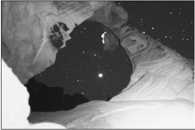
The planet Mars, an object of fascination for centuries, appears as a bright light in the night sky.
flare brilliantly and then reverse its course and start traveling backward. Because of its peculiar behavior, along with its fiery red color, Mars was associated with war, violence, danger, and death. As a result, some ancient peoples named the planet after their gods of war. The Greeks called it Ares, and the Romans called it Mars.
Thousands of years have passed since Mars was thought to be a brilliant red star shining in the night sky, but the human fascination with the planet has far from diminished. Since the 1960s, sophisticated technology and modern space missions have provided scientists with a wealth of knowledge and information. Still, many questions remain unanswered. For instance, even though it is doubtful that life exists on Mars today, was there a time when it did? If so, what happened to it? The absence of living things is likely related to the lack of water on the planet, which is another unsolved mystery. Scientists have tangible proof that water once ran freely on Mars, but there appears to be no trace of surface water now. What caused it to disappear?
Why Explore Mars?
As space exploration continues, additional pieces of the Mars puzzle will fall into place. Yet some people question whether it is worthwhile to study Mars at all. Space missions are extremely expensive, costing billions of dollars every year, but scientists are convinced that Mars exploration is crucial and must continue. That is because Mars is quite similar to Earth, and about 4 billion years ago, when the two planets were formed, they may have been almost identical. Geologists believe there was a time when Mars had a warmer and wetter climate, vast quantities of surface water, and an atmosphere that was much like Earth’s. Over the course of its history, however, Mars has undergone such drastic changes that it looks as though it is caught in the grip of a global ice age. Today, the planet’s surface is dry and lifeless, its atmosphere is unfit for human life, and its average daily temperature is more bone-chilling than even the coldest place on Earth. What caused these drastic changes? And is Earth destined for the same fate? By continuing to explore Mars, scientists

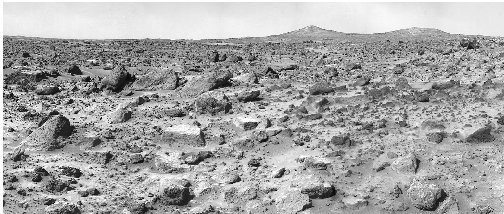
A photograph of Mars reveals a rocky surface that seems devoid of life.
can gain a much greater understanding of the red planet, as well as insight into what the future may hold for Earth.
source

 ESA’s global land cover map, claimed to be ten times sharper than any previous global satellite map, is now available to the public online from the GlobCover website. It is also claimed to be the highest resolution land cover map that has been completely validated ever released. Sixteen experts validated the map using more than 3 000 reference land cover points and showed it had an overall accuracy of 73% weighted by area for its 22 land cover classes. The map’s legend was developed using the United Nation Food and Agriculture Organisation’s (FAO) Land Cover Classification System (LCCS). The map was generated using 19 months worth of data from Envisat’s Medium Resolution Imaging Spectrometer (MERIS) instrument working in Full Resolution Mode to provide a spatial resolution of 300 m. Data were collected between December 2004 and June 2006.