Drift ice is ice that floats on the surface of the water in cold regions, as opposed to fast ice, which is attached (“fastened”) to a shore. Usually drift ice is carried along by winds and sea currents, hence its name, “drift ice”.
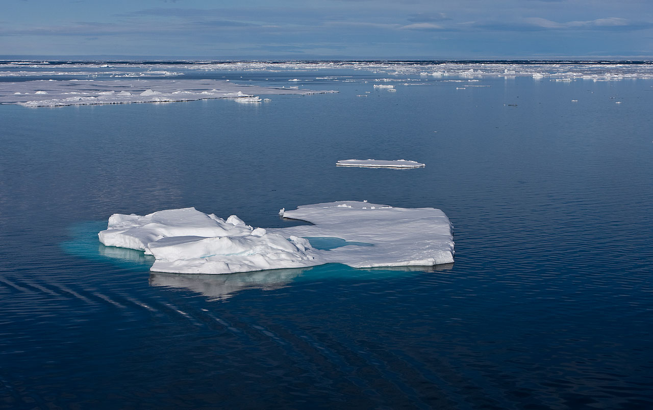
When the drift ice is driven together into a large single mass, it is called pack ice.
Wind and currents can pile up ice to form ridges three to four metres high, creating obstacles difficult for powerful icebreakers to penetrate. Typically areas of pack ice are identified by high percentage of surface coverage by ice: e.g., 80-100%.
An ice floe is a large piece of drift ice that might range from tens of metres (yards) to several kilometres in diameter. Wider chunks of ice are called ice fields.
The two major ice packs are the Arctic ice pack and the Antarctic ice pack.
In many areas such as the Baltic, drift ice is traditionally a seasonal event, appearing in winter and vanishing in warmer seasons.
Seasonal ice drift in the Sea of Okhotsk by the northern coast of Hokkaidō, Japan has become a tourist attraction of this area with harsh climate.The Sea of Okhotsk is the southernmost area in the Northern hemisphere where drift ice may be observed.
Some drift ice is permanent, because it has formed in an area which is extremely cold. While parts of the ice may eventually drop off and melt, the drift ice as a whole persists. Other types of drift ice appear seasonally, as cool weather promotes the formation of ice. It may also be carried on currents, appearing in unexpected places until it reaches a climate warm enough for the ice to melt.
One of the most famous forms of drift ice is pack ice. Pack ice is formed by the gradual compaction of ice, causing it to form a solid mass which can grow quite thick, especially when it is augmented by snowfall. In some regions, pack ice is solid enough to walk or drive on, and it can render a waterway impossible to navigate.
In an ice field, many large chunks of drift ice can be found floating. Ice fields are technically navigable, but they can pose a navigation challenge to all but the most skilled of sailors, because the individual chunks of ice each represent a collision hazard. Some chunks can get quite large, potentially dealing out fatal damage to passing ships.
Ice floes and icebergs are large chunks of drift ice which can wander far from the regions where they were formed. Tracking ice floes is often a topic of interest to researchers, as the movement of individual chunks of ice can reveal information about ocean currents and changes in ocean temperature. Iceberg and floe ice tracking is also important for navigational safety.
Worldwide, the incidence of drift ice is in decline, and land-based ice like glacier ice and ice caps is also on the decline. Scientists have feared that this may be due to increases in global temperature which inhibit the formation of ice and contribute to ice melts. The loss of ice is a dangerous indicator of global health, and also a potential problem in and of itself. Some people have theorized that if enough freshwater ice melts, it could impact ocean circulation in addition to causing a rise in sea levels, which could potentially be very problematic.
Source(s) :
Wise Geek
wikipedia

 China successfully launched its fourth orbiter into space at 23:53 Wednesday, as a part of its indigenous satellite navigation and positioning network known as Beidou, or Compass system.