
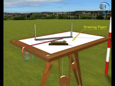
Plane table surveying is a graphical method of surveying where field observations and plotting are done simultaneously on a drawing board called a plane table. The plane table provides a stable, level surface on which a drawing sheet is fixed and maps or plans are directly sketched in the field. The surveyor uses an alidade to sight objects and draw lines on the sheet that correspond to directions of features on the ground. This method allows for real-time creation of scaled drawings by aligning the alidade with ground features and sketching their relative positions accurately.
Key steps in plane table surveying include:
- Centering the plane table exactly over a ground point using a plumb bob
- Leveling the table horizontally with a spirit level
- Orienting the table so directions on the sheet match directions on the ground, often using a compass or by back-sighting known points
- Fixing the drawing sheet securely on the table
- Taking sightings through the alidade and drawing rays/lines on the sheet corresponding to directions of visible objects or points
The method is especially suitable for small-scale surveys, industrial areas where compass surveys may fail, and for filling in detail between stations fixed by triangulation or traversing methods. There are several methods within plane table surveying including radiation, intersection, traversing, and resection, used for locating points or the plane table itself on the drawing.
This technique is advantageous because it avoids errors from omitting details or misinterpretation by allowing simultaneous observation and plotting. However, accuracy depends on proper setup and careful handling of instruments.
Instruments commonly used in plane table surveying include the plane table (drawing board on tripod), alidade (sighting and drawing rule), spirit level, compass, plumb bob or plumbing fork for centering, and drawing sheets or tracing paper.
Link(s) and Source(s):

