Tourism in Garhwal Himalayas: An Introduction

The ancient history of Garhwal says that it had once been a part of the Mauryan Empire.The history of Garhwal began as a unified whole in the 15th century, when king Ajai Pal merged the 52 principalities of the Garhwal region.Garhwal remained a consolidated kingdom for about 300 years, with Srinagar as its capital.But during the British Period, the territories of Pauri and Dehradun went under the British domain: the two region were given to the Britishers in return of their help during the Gurkha invasion in the 19th century.
Today the Garhwal region of Uttarakhand consists of 7districts, Chamoli, Pauri Garhwal, Uttarkashi, Dehradun, Rudraprayag,Haridwar and Tehri Garhwal
Garhwal is surrounded with high snow covered peaks, beautiful valleys, huge flat grasslands or alpine meadows, scenic surroundings, mighty holy rivers and has a large variety of rich and exotic flora and fauna.
There are well known and important tourist places to visit in Garhwal. Some of them are Mussoorie the queen of hills, Chamoli The land of the Gods, Uttarkashi, New Tehri, Pauri, Lansdowne and many more.
The char – Dhams – Gangotri, Yamunotri, Kedarnath and Badrinath. Haridwar and Hemkund Sahib are very sacred and holy place visited by lakhs of pilgrims from all over the world in the Garhwal Himalayas.
Garhwal is also a paradise for adventure sport tourists. They may choose to trek in the Nanda devi kamet, Pindari and the Gaumukh. The tourists can enjoy skiing in Auli and Dayara bugyal. Adventure Sports like Rafting, Bungee Jumping , Boating, Angling, Aero Sports and Hand Gliding and Paragliding in Rishikesh The Yoga Capital of the world and Pauri Garhwal.
Garhwal has a rich and exotic flora and fauna and the lush green jungles are abundant with pine, oak, rhododendron, juniper and birch trees. The wildlife tourism here is also rich with Tigers, Leopards, Elephants , Himalayan bear, wolves, snow leopards and varieties of deer such as barking deer and the musk deer that can be seen in the wild life sanctuary national parks here.

The Corbett national park, Rajaji national park, Govind wild life sanctuary, Nanda Devi wild life sanctuary, Kedarnath wild life sanctuary, Assan barrage and Chilla are well known wildlife sanctuaries in Garhwal.
The biggest dam of the world with height of around 830 mts and a capacity to generate around 2500 megawatts is located in the Tehri Garhwal district of Garhwal region. The Tehri dam provides clean drinking water to 40 lakhs people living in and around Delhi.
The world heritage sites such as the Valley of Flowers and the Nanda Devi are also in the Chamoli district of Garhwal Himalayas.
Dehradun, Haridwar and Rishikesh have good road, train and air connectivity New Delhi. The nearest airport is Jolly Grant airport .
Chamoli
Chamoli is a beautiful district in the Uttarakhand state of India. Gopeshwar is the headquarter of Chamoli Garhwal. It is situated at an altitude of 3000 ft – 12,000 ft above sea level. it has exceptional natural beautiful surroundings , major pilgrims centres and is surrounded by majestic snow covered peaks.
Dehradun
Dehradun is the gateway of Mussoorie.
It is the capital city of the state of Uttarakhand located in the Doon Valley on the foothills of the Garhwal Himalayas between two of India’s greatest rivers – the Ganges and the Yamuna. Click here to read about Indian Rivers.
Rudraprayag
Rudraprayag is a small town at an altitude of 3000 ft approx above sea – level in the Rudraprayag district of Uttarakhand. It lies on the Rishikesh to Badrinath route and is 142 kms from Rishikesh.
The town is located on the confluence of the river Alaknanda and the river Mandakani. The river from here then goes to Devprayag where is joins the Bhagirathi river and gets it name as the river Ganga.
Tehri Garhwal
Tehri Garhwal is a beautiful district in the Uttarakhand state of India. Tehri city is the headquarter of the district. The town is situated at an altitude of 1550 ft above sea level.
The river Bhagirathi, Alaknanda, Bhilangna, Alaknanda, Ganga all these mighty river run through Tehri Garhwal. Rudraprayag district and Uttarkashi district were both carved out of Tehri Garhwal.
The newly and modern Tehri town is almost 70kms from Rishikesh. This town was built when people from the old town were rehabilitated due to the building of Tehri dam in the area.
Pauri Garhwal
Pauri Garhwal is a beautiful district in the garhwal region of Uttarakhand India. Pauri city is the headquarter of the district. It is situated at an altitude of 1814ft above sea level on the Kandoliya hills of the garhwal mountains. Pauri Garhwal was a part of British Garhwal till the year 1970 when it was later merged in the Garhwal region. Rudraprayag district and Chamoli district were both carved out of Pauri Garhwal. It is a beautiful hill district with lush green valleys, varied flora and fauna and the majestic view of the Chowkhamba Mountain ranges. Thousands of tourist visit this beautiful hill station every year.
It is a beautiful and quite place, surrounded by Oak, Deodar and Pine forests to visit during the weekends. These majestic mountains, lusty green forests with panoramic views help you forget your worldly tensions and make you one with nature.
Haridwar
It lies in the Shivalik range amidst Bilva and Neel Mountains and is situated on the right banks of the river Ganga.
Haridwar means the Gateway to God, where ‘Hari’ – God and ‘Dwar’ – Gate. Haridwar is also known as Gangadwára or Hardwar. Haridwar was also known as Mayurapura ( Home of Peacocks) and Mayapura ( Goddess Maya Devi ) during olden times.

Uttarkashi
The beautiful hilly town Uttarkashi ( headquarters )is situated on right bank of the river Bhagirathi at an altitude of 1160 mts above sea – level.
Uttarkashi has a lot of religious importance. It was once known as Shivnagri during the puranic age and is also referred as the Kashi of the North It is home to two most important char dham yatra centre , the Gangotri and the Yamunotri.
Uttarkashi has wide and varied topography from the plains of the town at 1160 mts altitude to Tapovan at around 4330 mts above sea level. Around 90% of the region is hilly and covered with huge mountains and lusty green forest of Pine and Oak.

Source(s) and Link(s):
http://www.uttarakhand-tourism.com/garhwal/garhwal-tourism.php http://outstandingindia.blogspot.in/2008/08/history-of-uttarakhand.html

https://rashidfaridi.com/2014/08/05/clouds-at-mussorie/

Posted in Class Notes, earth, Tourism and Travel | 1 Comment

New Study Confirms: The Warming ‘Pause’ Is Real And Revealing 

oldbrew's avatarTallbloke's Talkshop

Credit: concernusa.org
GWPF Science Editor Dr David Whitehouse takes a close look at some recent developments in the long-running global temperature ‘pause’ controversy.

A new paper has been published in the Analysis section of Nature called Reconciling controversies about the ‘global warming hiatus.’ It confirms that the ‘hiatus’ or ‘pause’ is real. It is also rather revealing.

It attempts to explain the ‘Pause’ by looking into what is known about climate variability. They say that four years after the release of the IPCC AR5 report, which contained much about the ‘hiatus’ it is time to see what can be learned.

One could be a little sarcastic in saying why would Nature devote seven of its desirable pages to an event that some vehemently say never existed and maintain its existence has been disproved long ago.

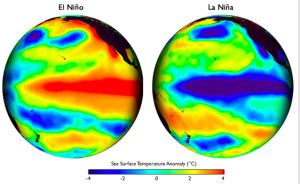
Now, however, as the El Nino spike of the past few years levels off, analysing the…

View original post 324 more words

Posted in earth | 1 Comment

“The ice edge is lost” – but can it be mapped?

RGS-IBG Managing Editor: Academic Publications's avatarGeography Directions

By Philip Steinberg, Professor of Political Geography, Durham University and Berit Kristoffersen, Associate Professor, Department of Social Sciences, UiT – The Arctic University of Norway

Stein&Krist Photo courtesy of US National Snow and Ice Data Center, http://nsidc.org/arcticseaicenews/files/2012/09/Figure4b.png

Drawing chaotic natures onto mobile seascapes

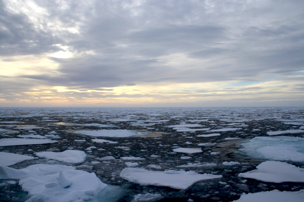
Amidst a steady stream of news stories announcing record-setting lows in sea ice extent, our recent publication in Transactions of the Institute of British Geographers asks a question that is fundamental to efforts to understand and manage our changing planet: What is sea ice?

Sea ice is never simply frozen sea water. It exists amidst dynamic processes of freezing, melting, and brine rejection; it supports complex ecosystems of primary algal production; its edge (where sea ice extent meets open water) is never clearly defined; and because that edge is perpetually moving it can never easily be mapped. Yet in spite of, or perhaps because of, sea ice’s indeterminacy…

View original post 792 more words

Posted in earth | Leave a comment

Various Uses of Sextant and How it Works

Even today big ships are all required to carry working sextants and the navigating officers have regular routines to keep themselves familiar with making it work. Despite all the Global Positioning Satellites, gyro compasses and radio communications it is at the end of the day an instrument that does not require any electricity or power of any sort to make it work. So when all else fails a sextant can still work. T here is one other instrument you need when using a sextant and that’s a clock that keeps Greenwich Mean Time to a very high accuracy. Plus you will need celestial tables and a good understanding of how to use the tables or do the calculations from principles. Ah and oh yes you will also need to be able to see things, the sun, moon, stars or bits of land. Not that you will need to see them all at the same time but just one would be helpful.

Taking the noon day sight is the traditional way navigating officers found there position in the old days.

Very simply this is how it works.

If you knew when your local midday was and knew what Midday Greenwich Mean Time is you can tell how far away from the Greenwich Meridian you are. For instance Classic Sailing’s office is near as damn it 5 degrees West. So midday here is 20 minutes after those of you in London. Simple maths, there are 60 x 24 minutes in a day, 1440, minutes and there are 360 degrees going right around the world.  So for every degree its 1440 / 360 = 4 minutes. Thus 5 degrees West is 5 x 4 = 20 minutes. Which may explain why Cornwall is always a little backward!

So how do you know when it’s your local midday. That’s when the sextant comes into use.

Basically a sextant measures the angle between two things. In this instance it is the angle between the horizon and the sun.

So checking to see you have sun light filters in place you look through the sextant and adjust a mirror to superimpose the image of the sun and the horizon. (The filters stop the sun blinding you.)

Watching carefully you will see the sun climb in the sky, keeping adjusting your mirror angle you will notice it stop climbing and begin to drop down again. Noting the time of the highest point gives you the local time of midday. In addition the angle of the sun will tell you how far south or north of the equator you are taking into account the date and various other considerations.

Moon and Stars 

So that is the most common usage of the sextant, but what if it’s cloudy and you can’t see the sun. Well that’s when you may need to wait until the sky clears at night time. Then you can take a sighting of a star or even the moon if you are very clever. Using your Nautical Almanac to work out where you are.

The sextant is the development of an older instrument called a Falstaff which measured the angle of the sun form the length of its shadow but that was always a bit tricky at sea.  Indeed the sextant did not come into its own until accurate time could be kept but that’s another story.

Land Ahoy

So far we have mentioned measuring the angle between the horizon the sun, moon and stars but it can also be used on its side. For instance you are approaching land and you see two known mountain tops. If you measure the angle between them and use a compass to point to one of the mountain tops you can then use the compass bearing and the sextant angle to draw your position on a chart.

How far away

With the sextant vertical you can measure the angle created between the horizon and the height of a known object such as a lighthouse, hill or mountain top.  You do need to know the tidal height as well but you can then work out how far away from the observed object you are.

Chase me if you can 

In the old days when one vessel was chasing or being chased measuring the angle of the mast head from the horizon would tell you very quickly if the other vessel was getting closer or going further away and by measuring the difference over a short time you could learn how much slower or faster than you they were. Particularly useful when the other vessel is a long way off and judgment by eye alone is difficult.

Horizontal Problem and Sextant

Source(s):

Classic Sailing


Posted in Class Notes, earth, Geography Practicals/Lab and Statistical Techniques | 1 Comment