Urban Morphology: Introduction and Evolution

Urban morphology is the study of the form of human settlements and the process of their formation and transformation. The study seeks to understand the spatial structure and character of a metropolitan area, city, town or village by examining the patterns of its component parts and the ownership or control and occupation. Typically, analysis of physical form focuses on street pattern,  plot) pattern and building pattern, sometimes referred to collectively as urban grain. Analysis of specific settlements is usually undertaken using cartographic sources and the process of development is deduced from the comparison of historic maps.

Special attention is given to how the physical form of a city changes over time and to how different cities compare to each other. Another significant part of this subfield deals with the study of the social forms which are expressed in the physical layout of a city, and, conversely, how physical form produces or reproduces various social forms.

The essence of the idea of morphology was initially expressed in the writings of the great poet and philosopher Goethe (1790). However, the term as such was first used in bioscience. Recently it is being increasingly used in geography, geology, philology and other subject areas. In geography, urban morphology as a particular field of study owes its origins to Lewis Mumford, James Vance, and Sam Bass Warner. Peter Hall and Michael Batty of the UK and Serge Salat, France, are also central figures.

Urban morphology is considered as the study of urban tissue, or fabric, as a means of discerning the environmental level normally associated with urban design. Tissue comprises coherent neighborhood morphology (open spaces, building) and functions (human activity). Neighborhoods exhibit recognizable patterns in the ordering of buildings, spaces, and functions, variations within which nevertheless conform to an organizing set of principles.

This approach challenges the common perception of unplanned environments as chaotic or vaguely organic through understanding the structures and processes embedded in urbanization. Complexity science has provided further explanations showing how urban structures emerge from the uncoordinated action of multiple individuals in highly regular ways. Amongst other things this is associated with permanent energy and material flows to maintain these structures.

Urban morphology comprises the structure of a city and pattern or plan of its development. It is actually the layout of a city both in its history as well as geographical contexts which gives it individuality. Therefore, the internal pattern or structure of each city is “unique in its particular combination of details”.

Combinations involving the structure of most American cities have a business, industrial and residential districts. The cities of the Western world in their structure display generally city centre or downtown, Central Business District (CBD) including shopping centre, industrial estate, and housing estate giving it a spatial framework in order to make sense of the environment in which people live and work.

In case of an Indian town, E. Ahmad has identified some of the components of urban morphology as site characteristics, historical background, sky-line, green open spaces, and water bodies, physical and cultural dominants. In combination these elements from the ‘urban landscape’ which is actually the soul and spirit of physical morphology of a town.

Speaking precisely, the morphology of a town is a geographic and historical interpretation of its site, situation or modality and existing layout and arrangement of houses as well as streets and loads. It also includes within its purview the development of different parts of the town and analysis of its boundary in different phases of history as well as explanation of existing land use. Urban morphology 01 a town’s anatomy and physiology are mutually interrelated.

The town is both a historical and geographical entity. Its morphology represents various elements which form part of its structure, plan, and growth. Its relief and terrain on which its nucleus seeks origin form a base. Its expansion from the nucleus shapes its morphology through streets and roads, houses and buildings and finally develops its functions as a trading and commercial centre with all the complexities of its adminis­trative and cultural services. Its plan, during various phases of history, may change to cope with the changing scenario.

Source(s):

YourArticleLibrary

Wkipedia

Links

 Assignments Submitted by Students
Ashna’s

Laskar’s

Shafiq’s

Syed Aiyazuddin’s

Wajeeha’s

Toiba’s

Hilal’s

Heena’s

Farhin’s

Assma’s

Mandal’s

Sharda’s

Noman’s

Afzal’s

Sadiq’s

Maheen’s

Juvairiya’s

Sabia’s

Posted in earth | Leave a comment

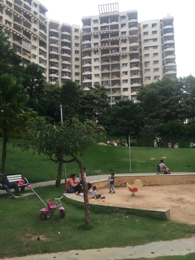
Urban Green in Bangalore

Posted in earth | Leave a comment

Free download of Henri Lefebvre, Metaphilosophy, Verso until September 7, 2019

stuartelden's avatarProgressive Geographies

Meta-Philosophy.jpgDownload Metaphilosophy by Henri Lefebvre – for free! – until Saturday, September 7th!

Until September 7th, we’re giving away the ebook edition of Henri Lefebvre’s Metaphilosophy. An essential book on our Philosophy: Verso Student Reading list, and a key text in Lefebvre’s oeuvre, Metaphilosophy is a milestone in contemporary thinking about philosophy’s relation to the world.

Ends Saturday, September 7th at 10.00 BST – if you have clicked through to this page after that time then you have missed this free ebook download.

Metaphilosophy
by Henri Lefebvre Edited by Stuart Elden Translated by David Fernbach

In Metaphilosophy, Henri Lefebvre works through the implications of Marx’s revolutionary thought to consider philosophy’s engagement with the world. Lefebvre takes Marx’s notion of the “world becoming philosophical and philosophy becoming worldly” as a leitmotif, examining the relation between Hegelian–Marxist supersession and Nietzschean overcoming. Metaphilosophy is conceived of as a transformation of philosophy, developing it into a programme…

View original post 157 more words

Posted in earth | Leave a comment

Why Indus Valley Civilization Declined?

The Harappan Civilization or the Indus Valley Civilization was a fascinating urban civilization in the world that flourished in the vast plains created by the River Indus and its tributaries. The Harappan Civilization thrived between 2600 – 1900 BC in the region that is now in Pakistan and India. With a population of over five million, this civilization had a well-developed trade system, cities, sewerage system, metallurgy techniques with many other mathematical and scientific achievements.

But with time, there was shrinkage in the Harappan Civilization. For instance, Mohenjodaro, one of the major cities of this civilization, earlier flourished on about eighty-five hectares of land but later on got confined to just three hectares. Due to some reason, the population from the Harappa started moving to the nearby and outer cities and places like Punjab, Upper Doab, Haryana, etc. But what leads to the decline of the Harappan Civilization is still a mystery.

Proposed theories regarding the decline of the Harappan Civilization

The definite reason that led to the decline of the Indus Valley Civilization is not known, as no reliable resource of that period is available at present. Every conclusion regarding the decline is based upon speculations of historians. Though the reason for the decline is not known, through excavations it is clear that the fall of the Harappan Civilization occurred between 1800 BC to 1700 BC.

It is commonly believed that the Aryans were the next settlers. They were skilled fighters, so their attack might have led to the destruction of the Harappan Civilization. The epics of the Aryans mentioned about their victory over the great cities. The human remains found during the excavation of Indus valley point towards some violent cause of their death. Now many historians, who do not believe this theory, say that the Aryans might not be involved in any such attack.

Owing to this conflict, the theory of a huge climatic change or natural disaster gained credibility. It has been found out that around 2000 BC some major climatic changes started occurring in the Indus Valley. These changes had led to floods in the plains and cities. Historians have found evidence to prove this theory as well. Most of the cities in the Harappan Civilization have been found in a condition as if these had been first abandoned and then rebuilt.

Cities, for instance, were initially built with great care but the reconstruction of the same was done with broken bricks and no attention was paid to the proper sewage system during reconstruction. Proper sewage system was one of the major characteristics of the Indus Valley Civilization.

Then, there was a fall in the average rainfall in the cities leading to the formation of desert-like condition. This led to the decline in agriculture on which most of the trade was dependent. Owing to this, people of the Indus Valley started shifting to some other location leading to the decline in the entire civilization. As per some scholars, the reason for the decline is the change in the course of River Ghaggar-Harka that had led to an increase in the aridity of the place. Around 2000 BC, there was found an increase in arid conditions. The location where the Indus valley civilization once flourished is a desert today.

Many theories have been formulated and provided, but all the theories met with one or another form of criticism. Archeological evidence does prove that there was no sudden collapse of the Indus Valley Civilization but it declined over a period of time and got mingled with other civilizations of that period.

List of Archaeological Sites of Indus Valley Civilisation

Thinkers Opinion
Stuart, Piggott, and Gordon-Childe External aggression (Aryan invasion)
MR Sahni Inundation
KVR Kennedy Epidemic
Marshall and Raikes Tectonic disturbances
Aurel Strein and AN Ghosh Climate Change
Walter Fairservis Deforestation, scarcity of resources, ecological imbalances
Marshal, SR Rao, Maickey Flood
GF Hales The destruction due to change in the course of river Ghaggar.
Wheeler In his Ancient India mentioned that the climatic, economic and political civilisation and argued that the decline was actually due to large-scale destruction.
George Dales In his ‘The Mythical Massacre at Mohenjo-Daro’ refuted Wheeler’s Theory of Invasion, and argues that the skeletons found did not belong to the Harappan period and were burials of irreverent nature.

The decline of the civilisation was attested by the following major changes:

  1. The disappearance of seals, the script, distinctive beads and pottery.
  2. The shift from the standardized weight system to use of local weights.

  3. The decline and abandoned cities.

  4. The Aryan invasion was believed to be major reason for the decline of Harappan Civilisation.

The material culture transformed into a few Harappan sites so occupied after 1900 BC. Distinctive artifacts such as weights, seals, bead, etc. disappeared. House construction techniques deteriorated, large public structures were no longer produced.

Source(s):

mapsofindia

JagranJosh

Wikipedia


Posted in earth | Leave a comment