CfP: The Journal of Urban Cultural Studies invites submission of abstracts to be included in the interactive short paper session at the Association of American Geographers Conference to be held March 23-27, 2023, in Denver. The Urban Cultural Studies session features innovative research that connects urban geography and cultural studies in order to better understand the […]
In 1933, Walter Christaller introduced Central Place Theory (CPT) as a way to explain the location, number, and size of settlements, where these locations acted as central places that provided services to surrounding areas.The theory talks about the concept of Centrality and Hierarchy of service centres in Geographical Space.
Central Place Theory also sought to explain the economic relationships of cities with smaller settlements. It also seeks to explain why cities are located where they are geographically and how they serve the surrounding smaller settlements with speciality goods and services.
The theory was used to explain a generally isotropic landscape, that is a flat and homogeneous surface, and how varied settlements dispersed on such surfaces. The population was seen as generally evenly distributed with settlements being generally equidistant.
In the standard view, consumers and sellers also have generally equal economic and purchasing power, which affects markets and placement of services. Given these assumptions, then a number of results are observed.
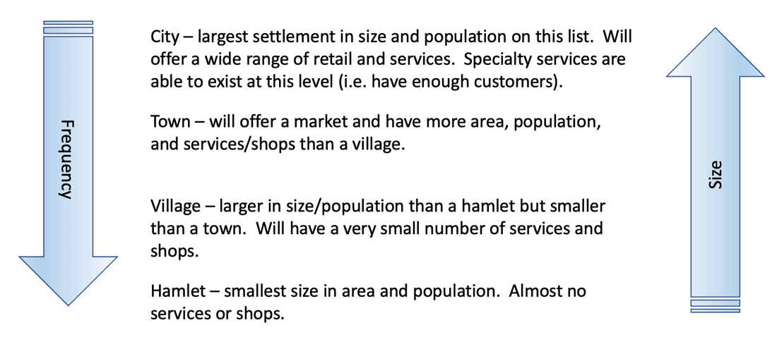
First, as settlements get bigger, then fewer large settlements emerge. The larger settlements grow the further larger settlements are from each other. As settlements grow, its range and functions that it provides also grow. As settlements grow, they tend to specialize more and provide greater services.
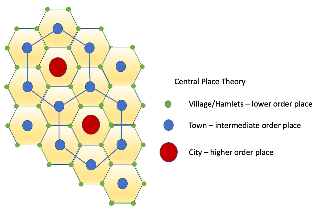
Central Place Theory can be visualized is a pattern of hexagons and networks that form when setting up the arrangements of the different order of settlements. Over a homogenous landscape in terms of population distribution, soil fertility, and transportation systems, lower order settlements (villages and hamlets) form a hexagon pattern around intermediate order settlements (towns) which in turn form a hexagon around higher order settlements (cities).
Distribution of goods and services is then served to the settlements closest to the central place. High order settlements offer specialized goods and services that requirement a higher threshold of demand.
The hexagon pattern formed by the distribution of different order settlements in Central Place Theory.
Methods have varied as to how scholars have tried to evolve or define different theories in explaining urbanism or the spread of settlements. One approach has been to use more dynamic methods, such as entropy maximization, to effectively use interaction flows and system-level changes, similar to system dynamic models, to look at how cities or towns change. This includes incorporating both local and international factors that cause systems to change.
Cities can grow based on advantages and enhancements to improved flow of people and goods, while reductions in this can diminish their populations.
Places with greater services and that are near consumers can be shown to have greater attractive pull for consumers according to gravity model of migration. Distance decay forms an important concept, where the effect and power of a service is based on the role of distance. However, not all services are distance dependent, meaning the role of distance can be made to vary from high to low depending on the type of service.
Recent research has shown is that CPT needs to be integrated with other dynamic approaches, such as spatial interaction models,, and related work in order to better explain dynamic growth and change in urban regions.
Cities are leaders in climate policy and planning, and many cities have developed local climate action plans (CAPs) that envision strategies to reduce emissions and increase resilience in a changing climate. Hundreds of local governments in California have adopted such plans, ranging from dense Bay Area cities to rural Central Valley counties. However, few of…