
West Asia, also known as the Middle East, has diverse landforms that include mountains, plateaus, deserts, and river valleys. The major landforms of the region include:
Mountains:
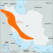
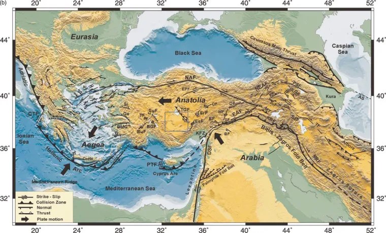
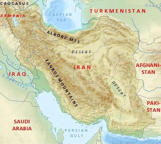
- Zagros Mountains (Iran, Iraq) – A rugged range that extends from western Iran into Iraq.
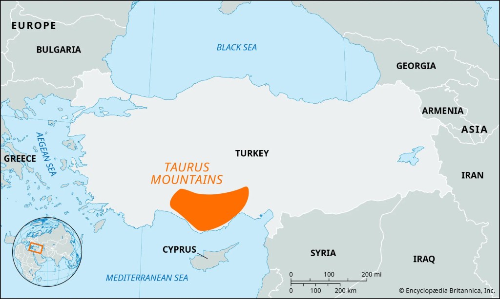
Taurus Mountains (Turkey) – A prominent mountain range in southern Turkey.
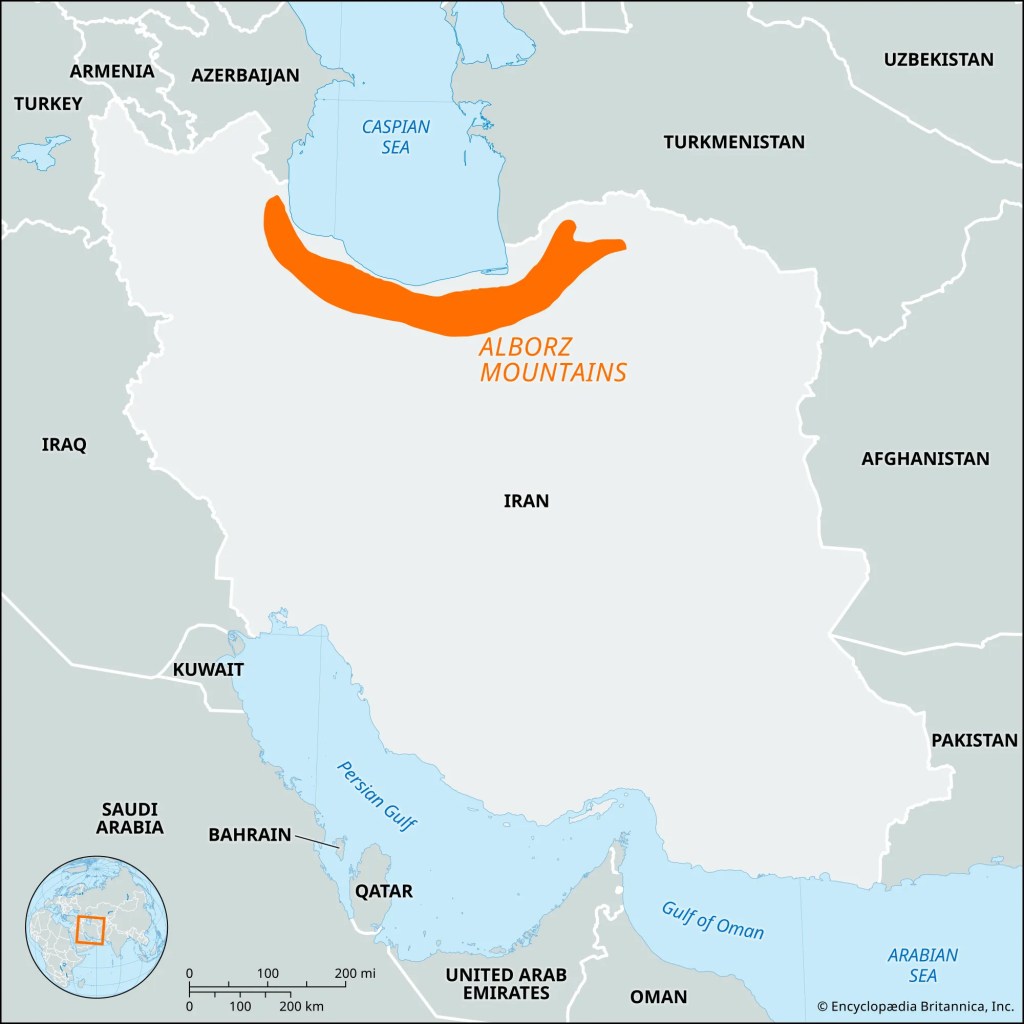
- Alborz Mountains (Iran) – Includes Mount Damavand, the highest peak in West Asia.
- The Alborz Mountains are a 900 km (560-mile) range in northern Iran, stretching from Azerbaijan to the Caspian Sea and the Khorasan region. Known for the 5,610-meter (18,410-ft) volcanic peak Mount Damavand, the range separates the Caspian coast from the arid Iranian plateau. It serves as a major recreational, cultural, and ecological hub featuring hiking, skiing, and diverse wildlife.The Alborz Mountains are a 900 km (560-mile) range located in northern Iran, extending from Azerbaijan to the Caspian Sea and the Khorasan region. This mountain range is home to Mount Damavand, a 5,610-meter (18,410-ft) volcanic peak, and it separates the Caspian coast from the arid Iranian plateau. The Alborz Mountains serve as a significant recreational, cultural, and ecological hub, offering opportunities for hiking, skiing, and boasting a diverse array of wildlife.
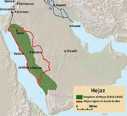
- Hijaz and Asir Mountains (Saudi Arabia) – Mountain ranges along the western Arabian Peninsula.
Plateaus:
- Anatolian Plateau (Turkey) – A highland region in central Turkey.
- Iranian Plateau (Iran, Afghanistan, Pakistan) – A vast plateau covering much of Iran and extending into neighboring countries.
- Najd Plateau (Saudi Arabia) – A central plateau in the Arabian Peninsula.
- Deserts:
- Rub’ al Khali (Empty Quarter, Saudi Arabia, UAE, Oman, Yemen) – One of the largest continuous sand deserts in the world.
- Syrian Desert (Syria, Jordan, Iraq, Saudi Arabia) – A mix of rocky and sandy desert.
- Dasht-e Kavir and Dasht-e Lut (Iran) – Salt and sand deserts in central and eastern Iran.
- River Valleys and Plains:
- Mesopotamian Plain (Iraq, Syria, Kuwait) – Formed by the Tigris and Euphrates rivers, historically known as the “Cradle of Civilization.”
- Jordan Valley (Jordan, Israel, Palestine) – Includes the Jordan River and the Dead Sea, the lowest land point on Earth.
- Indus Plain (Pakistan, Iran) – The western edge of the fertile Indus River Basin.
- Coastal and Island Features:
- Persian Gulf and Arabian Sea Coastlines – Important for trade and oil exports.
- Red Sea Coastline – Features coral reefs and maritime trade routes.
- Islands such as Bahrain, Socotra (Yemen), and Kish (Iran).
These landforms shape the climate, economy, and settlement patterns of West Asia, influencing agriculture, water availability, and urban development.


