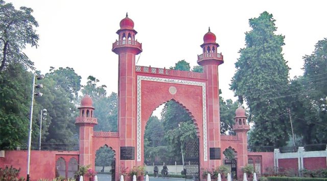
Happy Sir Syed Day: Are We Following His Vision?

sirsyedahmedkhan

The Man

Ye mera chaman hai mera chaman, main apne chaman ka bulbul hun
Sar-shaar-e-nigah-e-nargis hun, paa-basta-e-gesu-e-sumbul hun


Jo taaq-e-haram mein roshan hai, wo shama yahan bhi jalti hai
Is dasht ke goshe goshe se, ek joo-e-hayat ubalti hai
Ye dasht-e-junoon deewanon ka, ye bazm-e-wafa parwanon ki
Ye shahr-e-tarab roomanon ka, ye khuld-e-bareen armanon ki
Fitrat ne sikhai hai ham ko, uftaad yahan parwaaz yahan


Gaaye hain wafa

majaz

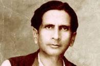
Majaz:An Alumnus and a Legendary Poet who created the Legandary AMU Tarna

ke geet yahan, chheda hai junoon ka saaz yahan
Ye mera chaman hai mera chaman, main apne chaman ka bulbul hun
Is bazm meiN taigheiN khencheen hain, is bazm meiN saghar tode hain
Is bazm meiN aankh bichhai hai, is bazm meiN dil tak jode hain
Har shaam hai shaam-e-Misr yahan, har shab hai shab-e-Sheeraz yahan
Hai saare jahan ka soz yahan aur saare jahan ka saaz yahan
Zarraat ka bosa lene ko, sau baar jhuka aakaash yahan
Khud aankh se ham ne dekhi hai, batil ki shikast-e-faash yahan

Jo abr yahan se uthega, wo saare jahan par barsega
Har joo-e-rawan par barsega, har koh-e-garan par barsega
Har sard-o-saman par barsega, har dasht-o-daman par barsega
Khud apne chaman par barsega, ghairon ke chaman par barsega
Har shahr-e-tarab par garjega, har qasr-e-tarab par kadkega

Ye abr hamesha barsa hai, ye abr hamesha barsega
Barsegaa, Barsegaa, Barsegaaa…
~ Majaz Lakhnawi

To download AMU Tarana click here.


amu

The Mission

AMU tarana always inspires me. It gives goosebumps to me.But the same tarana raises some questions in me. Are we up to the mark for these words? Are we striving for the same degree of excellence? Have we achieved the ‘Inferadiyat‘ strived for?

The mission has evolved in a grand and beautiful university. In the physical sense the mission is fulfilled, but are we following his vision as well? I am quoting some statements from Sir Syed. I call upon all the ALIGS to introspect and to search for the answer from within.

Sons and Daughters (of MAO college later AMU)) shall go forth throughout the length and breath of the land to preach the message of free inquiry, of large hearted toleration and of pure morality”

“Acquisition knowledge of science and technology is the only solution for the problems of Muslims.”

“We will remain humiliated and rejected if we do not make progress’’ (in scientific field)

“Get rid of old and useless rituals. These rituals hinder human progress.”

“Superstition cannot be the part of Iman (faith).”

“The first requisite for the progress of a nation is the brotherhood and unity amongst sections of the society”.

“Yes the main purpose of this college (MAO) is to impart modern education to Muslims who are suffering because of lack of it but this institution is for all, Hindus and Muslims alike. Both of them need education.”

 “We (Hindus and Muslims) eat the same crop, drink water from the same rivers and breath the same air. As a matter of fact Hindus and Muslims are the two eyes of the beautiful bride that is Hindustan. Weakness of any one of them will spoil the beauty of the bride (dulhan)”.

“We (Hindus and Muslim) have evolved a new language Urdu”.

“I wish that youth of India should follow the example of young men and women of England who are religiously engaged in the hard work of industrial development of their country” (During the stay of Sir Syed in England).

“Look forward, learn modern knowledge, do not waste time in studies of old subjects of no value.”

“Ijtihad (innovation, re-interpretation with the changing times) is the need of the hour. Give up taqlid “(copying and following old values).

“Do not show the face of Islam to others; instead show your face as the follower of true Islam representing character, knowledge, tolerance and piety.”

“We should not (by remaining ignorant and illiterate) tarnish the image of our able elders”.

“All human beings are our brother and sisters. Working for their welfare is obligatory for Muslims.”

“Remember that the words Hindu and Muslim are only meant for religious distinction: otherwise all persons who reside in this country belong to one and the same nation.”

And Some More Questions:

Afzal Usmani Bhai has raised some questions. I was thinking on same line but he presented the spirit beautifully so , I am reproducing with his permission.

  1. Do we really care about Sir Syed and his mission ?

2. If we care, do we really know what was his mission ?

3. If we know what are we doing to fulfill his mission ?

4. Are we really trying to fulfill his mission or promoting our self under the pretext of promoting Sir Syed Mission ?

Posted in Discussions, earth | 1 Comment

Why it’s urgent to respond to India’s vital signs

By Rajiv Khosla & R S Bawa A June 2016 report by the World Bank, showed a decrease in the global growth forecasts from 2.9% to 2.4%. If forecasts are made today, the growth projections will see a further dip. This is due to – The predicament in the US Fed Reserve’s interest rate fixation, after…

via Why it’s urgent to respond to India’s vital signs — The Indian Economist

Posted in earth | Leave a comment

Major Industrial Regions of North America

Eight major Industrial Regions of North America  are

1. Southern New England

2. Mid-Atlantic States

3. Pittsburgh-Lake Erie Region

4. Detroit Industrial Region

5. Lake Michigan Region

6. Southern Appalachian Region

7. Eastern Texas

8. Pacific Coastal Region.

North American industrial region comprising of USA and Canada is a highly developed industrial region of the world. USA is now the wealthiest and most highly developed nation in the world. Southern Canada is also well developed.

The USA has become the world’s greatest industrial country. She had the immense advantages of space and virgin resources. The speed at which the indus­trial pattern of the USA is shifting and changing today is, in some sense, a measure of her industrial wealth and of the newness of her development.

The continent was peopled from the east. The oldest centres of industry lie along the eastern seaboard or in the valleys of the eastward flowing rivers. The industrial centres of the Middle West and of the Pacific coast are more recent.

The North American continent has many great industrial centres and a few industrial regions. This is partly the consequence of the widespread nature of the resources of the continent, and partly because of the late date at which industrialisation took place.

The devel­opment of transport facilities and in recent years the generation and transmission of hydroelectric power have tended to cut industry adrift from the coalfields It is now having few areas of large scale concentration. Figure 12.2 shows major industrial regions of North America, particularly of USA and southern Canada.

1. Southern New England:

This part of USA was the earliest to be developed by the settlers from England. Therefore, industrial growth also started earlier in this region. This is one of the oldest industrial regions in USA having a diversified industrial growth. The nucleus of the region is Boston with Connecticut; Massachusetts and Rhode Island are other major centres.

The two dominant industries which developed in this region are shipbuilding and textile, but both have now declined as newer centres with greater advantages have emerged in the Mid-Atlantic States, the Great Lakes and the West.

The engineering industry is still important, especially for the production of specialised goods, such as electrical machinery at Springfield, aircraft and armaments in Hartford, instrument-making at Bridgeport and textile-machinery manufacture at Worcester, Lowell and New Bedford.

Two towns, Boston and Beverly, are specialised in footwear machinery and the former is a shoemaking centre. The traditional textile towns are Lowell and Providence for woollen textiles; and New Bedford, Worcester and Fall River for cotton textiles; but these now produce mainly high-quality goods. Mass production is now more economic, farther south.

2. Mid-Atlantic States:

This region has a great diversity of manufactures. Inland, the variety of product, from the wrist watch to the giant locomotive; from the coarsest cotton to the finest silk; and from the deadliest and most powerful chemicals to perfumes are the outstanding characteristics of this industrial development.

Abundance of cheap and good anthracite coal of Pennsylvania, oil and natural gas from Appalachians have been important factors in encouraging development in the Mid-Atlantic Region. Coal is used in all units of this industrial region as a source of power but oil and gas are also important sources of energy. This is also the most densely populated part of the United States, a main source of skilled labour force, and this is also the main basis for the growth of enormous industrial conurbation from New York to Baltimore.

The main industrial cities of the Mid-Atlantic region are New York, Newark, Trenton, Philadelphia, Wilnington, Baltimore, etc. This vast conurbation from New York to Baltimore is known as Megalopolis.

New York, situated on Manhattan Island, at the mouth of this important Hudson route from the interior via the Mohawk and Hudson valleys, is the largest city in the United States. It has an excellent harbour, and kilometers of wharves along the shores of the Manhattan Island and Long Island.

Leading industries were food and allied products; clothing and other textile products; printing and publishing; chemical and allied products; electrical equipment; transport equipment; and instruments. The town of Albany lies near the confluence of the Mohawk and the Hudson, and is noted for iron and steel manufactures.

3. Pittsburgh-Lake Erie Region:

This is the region having greatest concentration of ferrous industries. This region accounts about one-fourth of ferrous and ferro-alloy products of the country. The famous Youngstown-Pittsburgh-Johnstown iron and steel triangle is located in the region. The other steel-producing areas are Wheeling, Cleveland, Louisville, Rookford, Flint, Steubenville and Detroit.

The other manufacturing centres engaged in diversified manufacturing activities are Chicago, Anderson, Midland, Iowa, St. Louis, Minneapolis, etc. In cities like Detroit, several industries have developed including motor vehicles, machinery, fabricated metals, machine tools and electronics.

Most of the iron and steel towns are spun in the vicinity of Pittsburgh, such as Mckeesport, Braddock, Carnegie, Homestead and Johnstown. The industry spreads northward up to Shenango valley to Sharon, up the Beaver-Mahoning valley to Youngstown and into Canton, Massillon, and other eastern Ohio towns.

It also spreads down the Ohio River to Weirton, Steubenville, wheeling Huntington, Ashland, Ironton and Portsmouth and up the Miami valley to Middletown. Pittsburgh also has the largest glass industry in the United States.

Johntown on the Conemangh, to the east of Pittsburgh, has a coal, iron and steel industry. Most of the ore comes from Lake Superior. Cleveland, on Lake Erie, is noted for iron goods, electrical engineering and machineries.

4. Detroit Industrial Region:

This is the greatest automobile manufacturing region of the USA, centred at Detroit. The city was at first a centre for wagon and carriage-making which later led to the assembly of automobiles in the region.

It is the headquarters of several giant motor corporations including Ford, Chrysler, and General Motors. Other locational advantages were the large market for cars in the Midwest, where other forms of transport, e.g., railways, were relatively poorly developed in the early 20th century; and the ease of transporting steel from Pittsburgh via Lake Erie.

The automobile industry extends to many other towns around Detroit, e.g., Lansing, Flint, Jackson, Pontiac, Dearborn and Toledo; and car assembly is linked with other branches of manufacture such as tyre-making, electrical wires, glass, batteries, paints, polishes, alloyed steel, spare parts and components.

5. Lake Michigan Region:

This area lies on the southern shores of Lake Michigan with Chicago as a main centre. There are some 10,000 factories in and around Chicago, amongst which the iron and steel plants are the most important.

The manufacturing industries around Lake Michigan are confined largely to Chicago and Gary where iron ore of the Lake Superior and of north meets coal from the south. Chicago, near the head of Lake Michigan, is now the second largest city in the United States.

Its chief advantage lies in the fact that railways from the north-west are obliged to pass through it in rounding Lake Michigan to reach the Atlantic, while it also forms a good centre for railways from the south. Chicago concentrates on motor vehicles and trucks, cement, chemicals, iron and steel goods, furniture, paper, cereal, baby food and pharmaceuticals.

Other industries are based on the agricultural products of the surrounding regions, e.g., meat-packing, grain milling and the making of agricultural implements and machinery. Gary near Chicago is important for iron and steel production.

Closely associated with the Chicago metropolitan area are such urban centres as Milwankee, Racine and Kenosha with their extensive iron and steel, motor vehicle, beverage, machinery, meat packing, leather and leather goods establishments. Chicago, Gary and Milwankee depend upon it now for the delivery of Upper Lake ore.

6. Southern Appalachian Region:

This is a very distinctive steel making area centred at Birmingham in the piedmont of the southern Appalachians in the state of Albania. The availability of coal and iron, later supplemented by oil and hydroelectric power from the Fall line are responsible for the growth of this industrial area. Other industrial cities of this region are Atlanta, Gadsden, Bessemer, Anniston and many others.

Cotton textiles and chemicals are now manufactured in several industrial towns of this industrial region where water power is available. It makes a very wide range of goods such as metal works, chemicals and machinery manufacture.

7. Eastern Texas:

The industrial development of this region is based on oil, as a source of fuel and as a raw material. The main centres of this region are cities of Dallas and Houston. This region is also rich in sulphur, rock salt and phosphate rock. This makes oil refining and chemical industries the most important in the region. Their situations on the coast have additional advantage of transportation.

The capital available by the oil industry helps in industrial development. Dallas has more than twelve oil refin­eries, chemical plants, synthetic rubber factory as well as steel milling and manufacture of mining equipment and consumer products. Dallas also has clothing and fashion industry and Fort Worth is famous for aircraft and aerospace industries.

8. Pacific Coastal Region:

This region is a narrow coastal strip running through Washington, Oregon and California. This is one of the great industrial agglomerations of the Pacific coast. Its industrial centres are San Francisco and Los Angeles.

This region is famous for food and beverages, automobiles, aircraft, metal fabrication, petrochemical and heavy chemical industries. The other industrial centres of this region are Portland, Seattle, Engine, Sacramento, San Diego, etc.

Apart from the above mentioned industrial regions, there are some large isolated industrial centres in USA which are known for their industrial products. St. Louis has meat-packing, flour-milling, footwear, and agricultural machinery indus­tries. Kansas City has similar manufacture of products plus aircraft and oil refining.

Others like Omaha, Cincinnati, Indianapolis, Denver, St. Paul and Minneapolis, and Memphis concern themselves mainly with agricultural industries, being located in the midst of America’s richest agricultural region. Flour-milling, meat-packing, cotton textiles and food processing are some of the major industrial undertakings.

Bordering the Gulf of Mexico are several towns that serve as the outlets of the Mississippi basin and have industries linked with the oil found in the region. New Orleans has oil refining, chemicals and cotton textile industries.

Posted in Class Notes, earth | 1 Comment

Choosing a Map Projection

   Every map must begin, either consciously or unconsciously, with the choice of a map projection and its parameters. The cartographer’s task is to ensure that the right type of projection is used for any particular map. A well chosen map projection takes care that scale distortions remain within certain limits and that map properties match to the purpose of the map.

Generally, normal cylindrical projections are typically used to map the world in its entirety .In particular areas near the equator are shown well. Conical projections are often used to map the different continents. The mid-latitudes regions are shown well, while the polar azimuthal projections may be used to map the polar areas. Transverse and oblique aspects of many projections can be used for most parts of the world, though they are usually more difficult to construct.

The selection of a map projection for a particular area can be made on the basis of:

  1. shape of the area,
  2. location (and orientation) of the area, and
  3. purpose of the map.

i.) Ideally, the general shape of the mapping area should match with the distortion pattern of a specific projection. If an area is approximately circular it is possible to create a map that minimizes distortion for that area on the basis of an azimuthal projection. The cylindrical projection is best for a rectangular area and a conic projection for a triangular area (figure below).

The choice of the map projection class (cylindrical, conical or azimuthal) depends largely on the general shape of the mapping area.

 ii.) The choice of the aspect of a map projection depends largely on the location (and orientation) of the geographic area to be mapped. Optimal is when the projection centre coincides with centre of the area, or when the projection plane is located along the main axis of the area to be mapped .

An oblique Mercator projection is used for mapping the Alaska State (zone 5001). The cylindrical projection plane is located along the main axis of the area to be mapped (source: P. H. Dana).

 iii.) Once the class and aspect of the map projection have been selected, the distortion property of the map projection has to be chosen. The most appropriate type of distortion property for a map depends largely on the purpose for which it will be used.

Map projections with a conformal distortion property represent angles and local shapes correctly, but as the region becomes larger, they show considerable area distortions. An example is the Mercator projection. Although Greenland is only one-eighth the size of South America, Greenland appears to be larger Maps used for the measurement of angles (e.g. aeronautical charts, topographic maps) often make use of a conformal map projection.

The Mercator projection is a cylindrical map projection with a conformal property. The area distortions are significant towards the polar regions. An example, Greenland appears to be larger but is only one-eighth the size of South America.

 Map projections with a equal-area distortion property on the other hand, represent areas correctly, but as the region becomes larger, it shows considerable distortions of angles and consequently shapes . Maps which are to be used for measuring areas (e.g. distribution maps) often make use of an equal-area map projection.

The cylindrical equal-area projection after Lambert is a cylindrical map projection with an equal-area property. The shape distortions are significant towards the Polar Regions.

 The equidistant distortion property is achievable only to a limited degree. That is, true distances can be shown only from one or two points to any other point on the map or in certain directions. If a map is true to scale along the meridians (i.e. no distortion in North-South direction) we say that the map is equidistant along the meridians (e.g. the equidistant cylindrical projection in the figure below). If a map is true to scale along all parallels we say the map is equidistant along the parallels (i.e. no distortion in East-West direction). Maps which require correct distances measured from the centre of the map to any point (e.g. air-route, radio or seismic maps) or maps which require reasonable area and angle distortions (several thematic maps) often make use of an equidistant map projection.

The equidistant cylindrical projection (also called Plate Carrée projection) is a cylindrical map projection with an equidistant property. The map is equidistant (true to scale) along the meridians (in North-South direction). Both shape and area are reasonably well preserved with the exception of the polar regions.

 In summary, the ideal map projection for any country would either be an azimuthal, cylindrical, or conic projection, depending on the shape of the area, with a secant projection plane located along the main axis of the country or the area of interest. The selected distortion property depends largely on the purpose of the map.

Some map projections have rather special properties. The Mercator projection was originally designed to display accurate compass bearings for sea travel. Any straight line drawn on this projection represents an actual compass bearing. These true direction lines are rhumb lines (or loxodromes). Thus, the route of constant direction between two locations is a always a straight line. For navigation, this is the easiest route to follow, but not necessary the shortes route

The rhumb lines (lines of constant direction) are shown as straight lines on the Mercator projection. The shortest distance between two points – the great circle path – is shown as a curved line.

 The gnomonic projection is a useful projection for defining routes of navigation for sea and air travel, because great circles – the shortest routes between points on a sphere – are shown as straight lines. Thus, the shortest route between any two locations is always a straight line. No other projection has this special property. In combination with the Mercator map where all lines of constant direction are shown as straight lines it assist navigators and aviators to determine appropriate courses. Changes in direction for following the shortest route can be determined by plotting the shortest route (great circle or orthodrome) from the Gnomonic map onto the Mercator map .

All great circles – the shortest routes between points on a sphere – are shown as straight lines on the gnomonic projection.

 In the 15th, 16th and 17th centuries, during the time of great transoceanic voyaging, there was a need for conformal navigation charts. Mercator’s projection – conformal cylindrical – met a real need, and is still in use today when a simple, straight course is needed for navigation. Because conformal projections show angles correctly, they are suitable for sea, air, and meteorological charts. This is useful for displaying the flow of oceanic or atmospheric currents, for instance.

For topographic and large-scale maps, conformality and equidistance are important properties. The equidistant property, possible only in a limited sense, however, can be improved by using secant projection planes. The Universal Transverse Mercator (UTM) projection is a conformal cylindrical projection using a secant cylinder so it meets conformality and reasonable equidistance. Other projections currently used for topographic and large-scale maps are the Transverse Mercator (the countries of Argentina, Colombia, Australia, Ghana, S-Africa, Egypt use it) and the Lambert Conformal Conic (in use for France, Spain, Morocco, Algeria). Also in use are thestereographic (the Netherlands) and even non-conformal projections such as Cassini or the Polyconic.

Suitable equal-area projections for thematic and distribution maps include those developed by Lambert, whether azimuthal, cylindrical, or conical. These do, however, have rather noticeable shape distortions. A better projection is the Albers equal-area conic projection with two standard parallels, which is nearly conformal. In the normal aspect, they are excellent for mid-latitude distribution maps and do not contain the noticeable distortions of the Lambert projections.

An equidistant map, in which the scale is correct along a certain direction, is seldom desired. However, an equidistant map is a useful compromise between the conformal and equal-area maps. Shape and area distortions are often reasonably well preserved. An example is the equidistant cylindrical projection  (also called Plate Carrée projection), where the meridians are true to scale map (i.e. no distortion in North-South direction).

The projection which best fits a given country or region is always the minimum-error projection of the selected class. The use of minimum-error projections is however exceptional.

Link(s), Source(s) , Inspiration (s) and Further Reading(s):

wikipedia

ITC Study Material

State Plane Coordinate System

Projections

Classes of Map Projection

Why Map Projection is an Issue in GIS

Datum,Ellipsoid,Rhumb Line,Secant, Spheroid, Tangent and Other Useful Terms

Celestial Sphere

Earth on Every Map Projection

Posted in Class Notes, earth, Geography Practicals/Lab and Statistical Techniques, map making | 1 Comment